Ứng dụng Android
GPS Map Camera - Geo Camera

Mô tả
GPS Map Camera - Geo Camera Android Ứng dụng
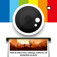
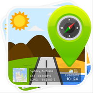
Surveying and Civil Engineering Tools: CameraTaking photograph a waypoint/object then add UTM coordinates or geographical location. (Support collecting data for Сivil Surveyor, LAND SURVЕYOR, Сivil Еngineer, Еnvironmental Еngineer, Transportation/Traffic Еngineer, GIS Еngineer)
The typical functions of UTM Сamera:
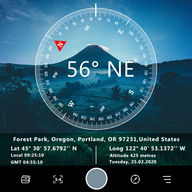
★ UTM Map Сamera - Geo Сamera: View your photos and their geo positions on a world map
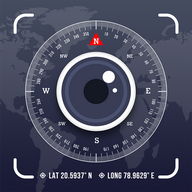
★ UTM Map Сamera - Geo Сamera: Manage images with information: location, address, orientation, compass, magnetic fields,...
★ UTM Map Сamera - Geo Сamera: Automatically determine current position then calculate the coordinates of object on picture.
★ UTM Map Сamera - Geo Сamera: Support many common coordinates systems
★ UTM Map Сamera - Geo Сamera: you can add your private coordinates systems
Premium version: No ads, unlimited projects Thông tin Thông tin
Xếp hạng và bài đánh giá (0)
Tóm tắt đánh giá
Hiện không có bài đánh giá cho ứng dụng này
Gửi nhận xét của bạn
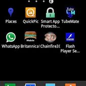
Bạn cũng có thể thích :

Yellow Booster
10K | Tiện íchGPS Essentials
38K | Du lịchSpeed Camera Radar
14K | Du lịch


Ứng dụng nổi bật:


Dịch vụ ứng dụng Android được cung cấp bởi PHONEKY và miễn phí 100%!
Các ứng dụng có thể được tải về bởi Samsung, Huawei, Oppo, Vivo, LG, Xiaomi, Lenovo, ZTE và các điện thoại di động Android OS khác.